ESAIL / SAT-AISParis Air Show 2017 (Le Bourget)Latest Artist's Launcher & Satellite ViewsArtist's Impressions - VariousTelecommunication
The ESAIL mission and SAT-AIS
Please sign in to download.
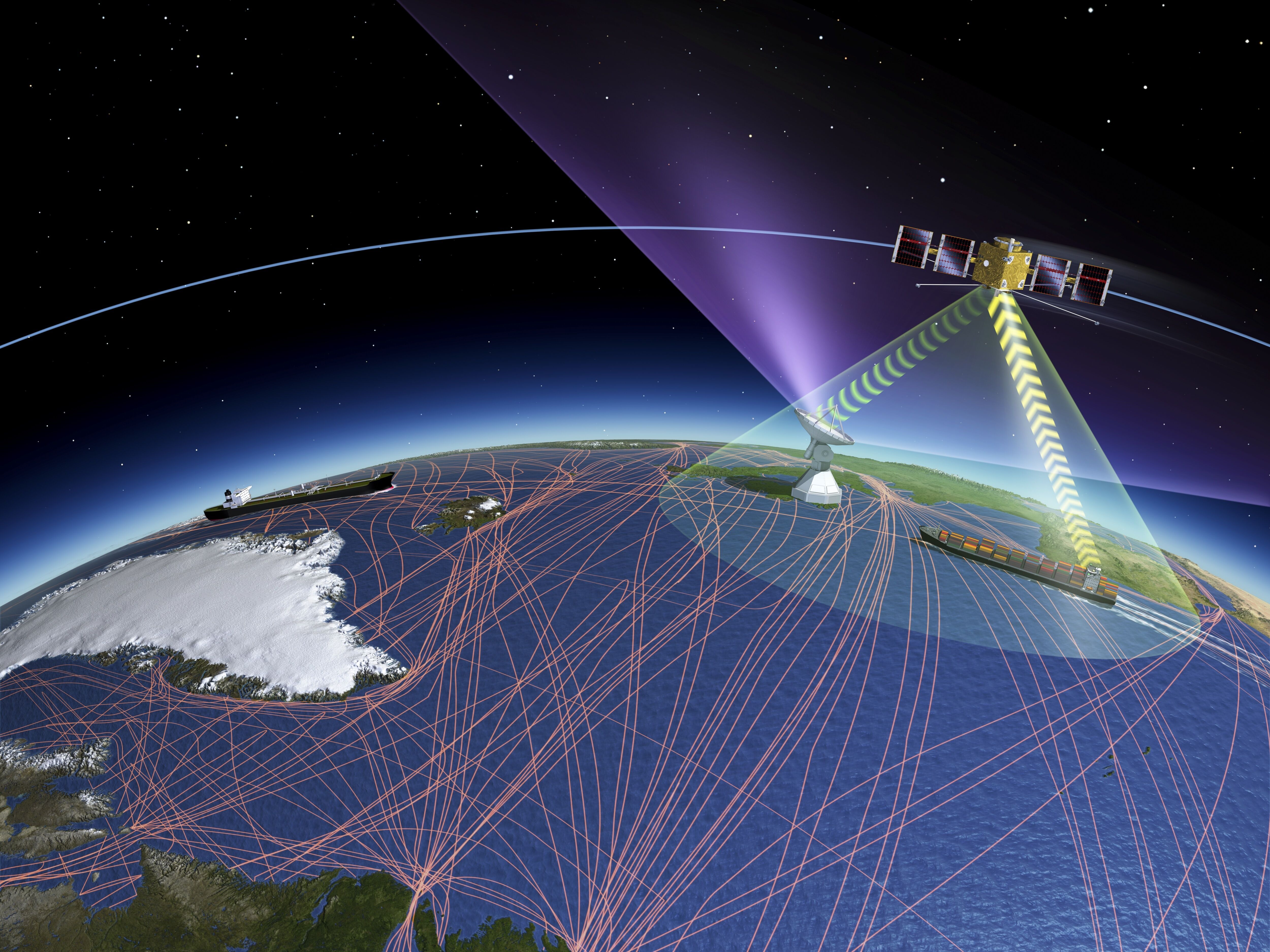
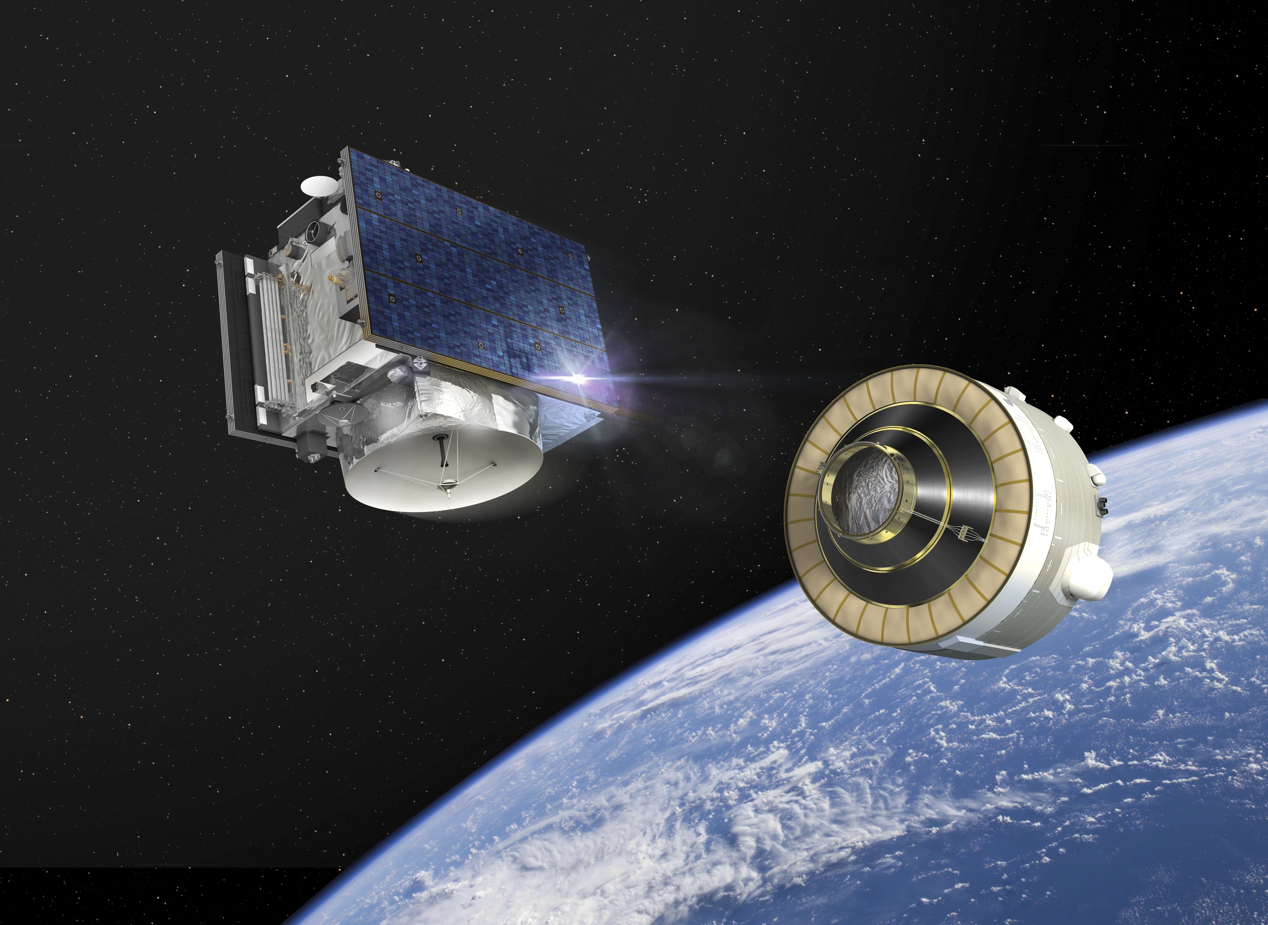
The ESAIL mission is a joint ESA LuxSpace project in an effort to extend the monitoring of maritime traffic beyond existing land-based tracking of Automatic Identification Systems (AIS) through the means of an array of microsatellites: SAT-AIS. Ships of 300 tonnes or more in international voyages, cargo ships of 500 tonnes or more in local waters and all passenger ships irrespective of size are mandated by the International Maritime Organization to carry Automatic Identification System (AIS) equipment. The international AIS is the maritime equivalent of air traffic control. This radio-based communications system was originally developed to prevent collisions of large vessels. It transmits the course and speed as well as identification and position information to other vessels and shore stations. AIS is also included in Aids-To-Navigation and Search and Rescue transponders. While AIS has been deployed globally, it suffers from a major limitation because Earth’s curvature limits its horizontal range to about 74 km from shore. This means that AIS traffic information is available only around coastal zones or on a ship-to-ship basis. Tracking ships using microsatellites (SAT-AIS) solves this problem. The ship’s identity is recorded and decoded by satellite then sent to ground stations for further processing and distribution. ESA is promoting SAT-AIS systems, technologies and services in partnership with the European Maritime Safety Agency, a regulatory agency established in the late 1990s along with a number of other major European maritime safety initiatives.
Related
Hera spacecraft

Hera uses infrared to scan impact crater

Hera heads into space

Milani studies asteroid dust

Hera scans Dimorphos with its laser altimeter

Hera scans DART’s impact crater

Hera networking with CubeSats

Hera glides past Didymos to Dimorphos

Hera approaches Dimorphos

Hera deploying CubeSats

Hera and its CubeSats at Didymos system

Hera, her CubeSats, and their rocky target destination

Mars seen from Hera's top 'asteroid deck'

Juventas studies asteroid's internal structure

Hera's instruments on its top 'asteroid deck'

Hera's Mars swingby
